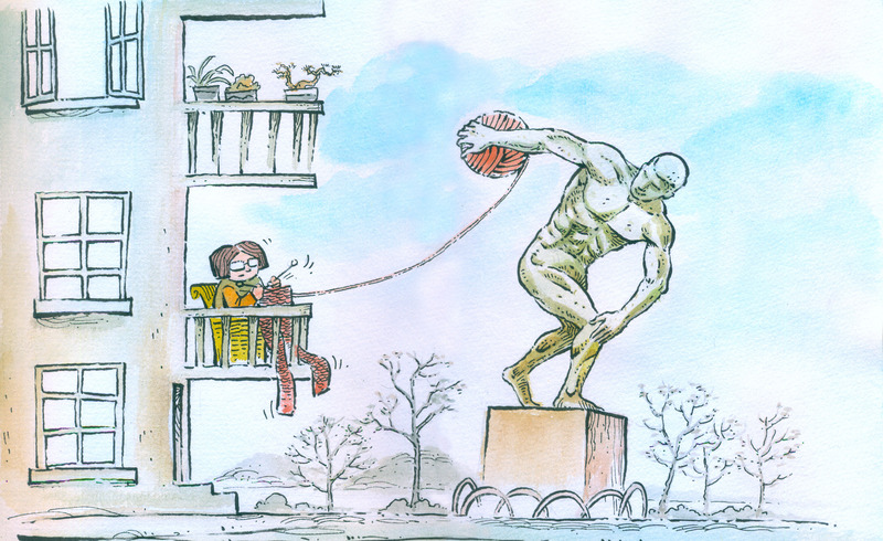
After the disappearance of this national treasure, its replica reappeared at the Beijing Antique Market! Do you know the mystery of these maps
Recently, the 2023 version of the standard map was officially released. People's lives cannot do without maps, and searching for addresses, navigation, ordering takeout, etc. all require the guidance of maps. In fact, the birth of maps is closely related to the origin of human civilization. Maps are a way for us to understand and express the world. The birth of maps is related to human imagination, and its development process is winding and interesting.
From Imagination to Cognitive Ability
The map we see now depicts the overall landscape of cities and the world on paper through different colored lines, symbols, and text. So, what was the initial appearance of the map?
Since ancient times, people's production and life have been inseparable from information such as location, orientation, and distance. Most ancient civilizations were isolated from each other, but they developed some form of map in the early stages. The embryonic form of a map is that people use their imagination to outline the surrounding environment on a picture.
In the Middle Ages, unknown land and oceans provided fertile soil for people's imagination. Especially under the influence of some folk legends, map makers have depicted the dangers that may exist in unknown territories, such as fictional creatures such as sea pigs, whales, and sea monsters, on the map.
With the improvement of human cognitive ability towards the objective world, maps are not only works with wings of imagination, but also a record of the world. In most regions, including China, early maps appeared in the form of drawings.
Globe table lamp
The Bedolena map, discovered in the province of Brescia in the Lombardy region of Italy, is considered the earliest map to appear in the world and the closest to modern map styles. This map is a painting from the Carmonica Valley rock art group, carved on rocks. This rock is approximately 4 meters wide and 2 meters high, and is densely covered with fields, roads, and houses. There are also figures of pedestrians and animals on the painting.

This map was drawn about 3000 years ago and is very similar to the floor plans of many urban blocks today. It presents the geographical features of a village from a positive overhead perspective. For example, roads, houses, etc. are drawn with simple lines and rectangles, and the rectangles representing fields are filled with dotted patterns to distinguish them from houses.
In August 1569, Dutch cartographer Mercato published the world map, which was the first comprehensive depiction of the spherical surface of the Earth as a flat map by humans. It was the first true world map. The world here is rectangular, not elliptical; The map has annotations for continents, oceans, Arctic, and magnetic poles, as well as the living customs of residents in different countries and the diversity of wildlife and plants.
The first world map born in China
The first world map born in China appeared over 400 years ago, very similar to today's world map, to the extent that people cannot believe that it did not come from Europe, which had just undergone a major geographical discovery, but was drawn in China.
The Kunyu Universal Map can be considered as China's first complete map of the world in terms of longitude and latitude. It was drawn by Matteo Ricci, a Western missionary during the Wanli period of the Ming Dynasty. Matteo Ricci, based on the map of the Western world at that time, moved the meridian 170 degrees to the left, thus changing the prevailing pattern of placing Europe at the center of the map. He placed the eastern part of Asia at the center of the world map. The five continents marked on this map include Antarctica, which was just discovered at the time. And Australia did not appear in the picture because it had not yet been discovered at that time.
The preservation of "Kunyu Wanguo Quantu" also has a tortuous experience. At the beginning of the 17th century, this map was gradually lost in China after being copied. It was not until 1922 that its copied version appeared at an antique market in Beijing. It was accidentally purchased by Han Bowen, the son of Han Yixuan, the owner of the Yuegu Studio in Beiping, for 20 yuan. Finally, it was recognized by experts as a Qing Dynasty palace collection. An American who frequently visited antique shops requested a high price to purchase this picture. Upon learning of this, Sun Boheng, the manager of the Commercial Press, immediately informed the preparatory office of the Beiping History Museum. Qiu Shanyuan, the then director of the museum, sent people to negotiate with Yue Gu Zhai and purchased the painting for a large sum of money.
After the outbreak of the War of Resistance Against Japan, the "Kunyu Wanguo Quantu" was moved south along with other cultural relics and circulated to the Preparatory Office of the Central Museum, which was the predecessor of the Nanjing Museum. After the establishment of the People's Republic of China, this map ultimately remained at the Nanjing Museum and became a treasure of the museum.
This large map recently appeared in a commercial building at Potsdam Square in the German capital Berlin, arousing the interest of passing tourists.
Intelligent, let the map read you
"Maps are not only a reconstruction of our understanding of the world, but also a window to glimpse human desires and imagination." This is the viewpoint written by the author in the book "The History of Maps.
From the earliest people carving location maps on stones, rocks, etc., to the emergence of truly professional maps, every change in maps is related to the transformation of human lifestyles.
With the development of information technology, the family of maps is becoming increasingly large, with not only paper versions but also electronic versions. The combination of digital maps and smartphones makes everyone's life more convenient. Maps have become a small helper in our lives in a different way.
Open the mobile map, which includes not only 2D platform maps and 3D city maps, but also satellite maps and street view maps. Travel information such as road conditions, real-time buses, charging stations, and real-time parking spaces can be easily accessed, and various types of information such as restaurants, hotels, shops, attractions, convenience stores, and gas stations in the city can be quickly searched.
With the widespread and in-depth application and development of map data, the future trend of electronic map development is user centric, evolving from "we read maps" to "maps come and read you".
For example, if you want to call a car, you don't need to actively input the location, but open the application and click the "call button". The map and geographic location information may seem unrelated to you, but they are used by you. Delivery services, door-to-door dry cleaning services, medicine delivery services, etc. can be obtained by simply pressing the "one click service" button. Future life scenarios may become more intelligent.
With the popularization of facial recognition technology, mobile map applications are also constantly expanding to achieve a more intelligent service experience. For example, promoting the popularization of facial recognition technology in mobile apps, achieving one click login, automatically identifying the user's location, and combining the information of the items carried by the user at that time to recommend the best itinerary and improve the experience.
Maps are becoming increasingly modern. The combination with fields such as autonomous driving, smart cities, and smart transportation has also opened up broader development space for mobile maps.
In the outdoor "geography classroom" of Hefei No.11 Middle School, students are watching a three-dimensional terrain globe.
The perfection of data cannot be separated from this profession
Maps are both an art and a tool. So, how did the world beneath our feet and some intricate scenes print onto the map?
Generally speaking, creating a complete map from data requires four processes - discovery, collection, processing, and publishing. Although with the development of technology, data collection methods are becoming increasingly advanced, such as aerial photography, satellite photography, 3D oblique photography, etc., manual sampling is still the best method to ensure data accuracy. The navigation tools we are accustomed to using today are inseparable from the hard work of map collectors. Their job is to drive collection vehicles equipped with various high-tech equipment, constantly collecting and updating geographic information in the streets and alleys of cities, rural landscapes and other remote areas.
How is manual data collected? Simply put, it can be divided into two types: vehicle sampling and step sampling. Checai records the shape and network relationship of roads, while also obtaining locations of interest to users such as dining, accommodation, and shopping around the roads; Step by step collection is a more detailed way to collect points of interest and add a variety of attributes.
Each car collector needs to have a natural skill, even if they stare at the computer screen all day on a bumpy car without feeling dizzy, which is also their hard work. And the Bucai collector can capture three to four hundred information points by scanning the street for a day. For example, information points such as buildings, hotels, restaurants, gas stations, etc. on mobile phone maps are collected one by one by walking collectors, and then input into the computer and uploaded to the system for users to use.