Looking at the past and present of this steel city in the United States, solving the revitalization and development of old industrial bases | cities | the United States
A long time ago, I read the story of Steel King Carnegie, and thus gained an understanding of a city that matched his name - Pittsburgh. In the past, this place was both a gathering place for merchants and a battleground for military strategists. The Monongasila River and Allegheny River converge here into the Ohio River, becoming the main waterway connecting the east and west of the United States. Due to the development of railways and the abundant reserves of bituminous coal, limestone, and iron ore in nearby areas, this used to be the largest steel base in the United States. However, after the 1990s, with the rising cost of canal transportation and the decline of the steel manufacturing industry, the status of the "City of Steel" also rapidly declined. If the Industrial Revolution and the opportunities for global steel development have shaped Carnegie, then Pittsburgh, as the base of the steel industry, experienced the dual transformation pains of industrial structure and urban function in the process of industrial revolution to post industrial revolution, and achieved a magnificent transformation.
Image caption: Allegheny River Trail and Westin Convention Center.
In late spring and early summer, on the occasion of an academic exchange conference at Michigan State University in the northern United States, we passed through Pittsburgh, where the Dream of the Steel Empire began, to experience the origin, prosperity, decline, and revival of this city.
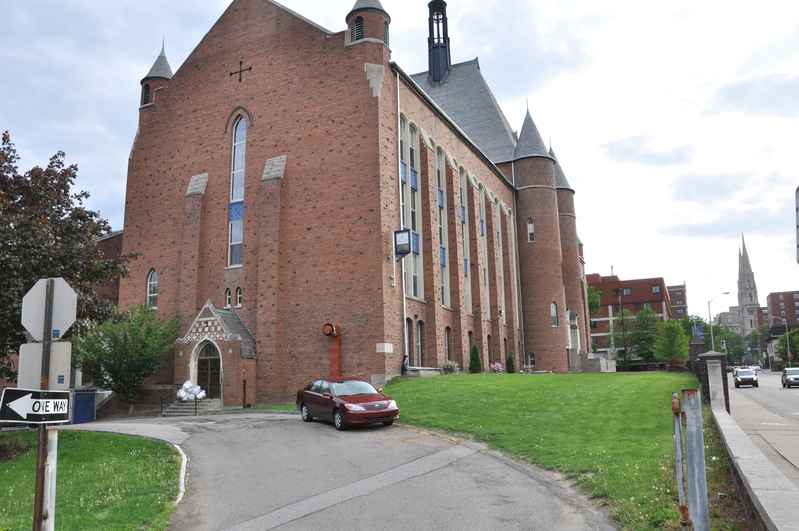
Starting from Highway 76 in Maryland, drive west along the Monongazilla River. The morning sunshine falls on the peaceful flowing river surface in the outskirts of Pittsburgh, and the shimmering water gently washes away the exposed riverbank, carrying red mud and sand slowly flowing eastward. The railway tracks built along the river pierce deeply into the riverbed and extend southward through a high arched steel bridge. The brick red Victorian style building on the opposite bank of the river is surrounded by undulating hills, with iron walkways spanning both ends of the building with single columns in the air. The broken bricks and exposed steel components on the walls are clearly visible. The towering chimneys not far away and the rutting marks left on the gravel covered road further highlight the prosperity here used to be. The outskirts of this former steel city are scattered with abandoned factories and railway tracks, witnessing the glory of the past.
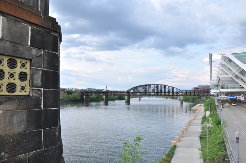
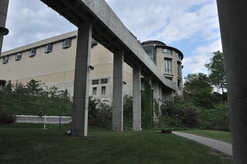
Image caption: A trail spanning buildings.
Arriving at Carrie Furnace Steel Plant Ruins Park - a steel plant that ceased production in the late 20th century and also the filming location for a documentary about Carnegie, "Escape from the Furnace.". Nowadays, it belongs to the Pittsburgh Film Company and has become a paradise for the American Museum of Modern Cinema and modern artists. The rust colored entrance sign and the sculpture with the red font "Carrie Furnace Tour" carved on the square in front of the door are particularly eye-catching, full of ruins and a sense of atmosphere. The damaged factory building is left with ruins and broken walls, and the mottled exterior walls are covered with moss. The base of the factory building is coated with thick white lime powder. Rusty iron components scattered randomly on the grass, and the rusty golden base of the steelmaking furnace accentuates the heaviness of the upper circular steel barrel against the backdrop of the greenery. The circular blast furnace above has been invaded by wind and rain, leaving traces of pollution and mold. The overgrown weeds around reflect the great changes of the times, and as a result, this place has become a tourist destination for many followers of post industrial civilization.
For a long time, universities have played a decisive role in the transformation and development of Pittsburgh. In the late 19th century, with its unique transportation location and abundant iron ore resources, the manufacturing industry flourished and cities rapidly expanded. However, the development of cities has also brought about significant resource dependence and environmental pollution, resulting in a prolonged economic recession. Cities have lost their vitality, and central commercial areas, residential areas, and factory areas have gradually become outdated and dilapidated. In order to get out of the predicament, the Pittsburgh city government has begun to implement a series of revitalization plans for the transformation of the "steel capital" - shifting the city's economic focus from manufacturing to education, tourism, and service industries, especially high-tech industries represented by healthcare and robotics. The close integration of universities and urban production and life has given rise to numerous creative services and high-tech innovation enterprises, and has changed the spatial structure of the entire city. Along the Monongasila River, a large number of concentrated residential areas have formed in the north and south, with the University of Pittsburgh and Carnegie Mellon University interspersed between them. The two schools embrace each other face to face, resembling a "university city" and forming an east-west extension of the central region.
Image caption: The square in the university town.
At the same time, a large number of modern industrial parks have gathered along the river in the north and south, mainly focusing on robotics and medical industries, forming a V-shaped spatial pattern in the central urban area. The three district linkage of university campuses, communities, and industrial parks has facilitated the integration and development of cities within universities and universities within cities, bringing new vitality to the development of Pittsburgh.
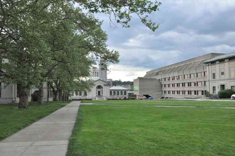
With curiosity about the two universities, we drove to visit the "University City". Through the dense treetops on both sides of the avenue, one can vaguely see a 42 story Gothic high-rise building standing ahead, which serves as the teaching and academic center of the school. On the east side of the building is a Baroque courtyard style building surrounded by a U-shaped natural history museum and art gallery donated by Carnegie. To the west is the modernist style Hillman Library and student activity center. These different styles of group buildings form a north-south symmetrical pattern around Shenli Square along the central axis. Importantly, at the beginning of its construction, most Pittsburgh residents voluntarily donated money to express their recognition and support for the education industry.
Image caption: University campus.
In the mid-20th century, with the decline of traditional manufacturing, Pittsburghs began to recognize the close connection between urban space, talent, and industry. By utilizing urban structural adjustment to optimize urban operational efficiency, we can achieve continuous spatial transfer of people, finance, and goods. The functional relationship between the central urban area and the suburbs has undergone a transformation, no longer limited to industrial and commercial centers, but gradually shifting towards education, tourism, and service industries. At the same time, there is a greater emphasis on cultural and community construction here, forming the early embryonic form of the spatial development pattern of metropolitan agglomerations. In the process of deindustrialization, waterfront development based on leisure and entertainment and landscape enhancement has become a new idea for urban innovative development.
The Delta Park Plaza located at the confluence of rivers and the development along the riverbank not only changed Pittsburgh's long-standing image as a "smoky city", but more importantly, became a catalyst for activating urban renewal.
The hundreds of kilometers of cycling and hiking trails starting from the Delta Park cross rivers, meander through mountain streams, surround mountain peaks, traverse mining corridors, and finally reach the Delta Park, becoming a major highlight of urban renewal. This has made Pittsburgh one of the most livable and healthy cities in the United States.
With a sense of anticipation, we strolled along the city trail by the Allegheny River in the afternoon. In the distance, on the left front, you can vaguely see the winding bicycle race track across the river, with riders wearing helmets shuttling between the mountain stream and residential communities. The Dukes Tramway, built in the 19th century, still bustles with people traveling between Washington Peak and Lincoln Avenue, becoming the most convenient passage for foreign tourists to reach the summit and enjoy the city's night view.
Image caption: The famous scenic spot in the city, the Veternas Bridge.
Nowadays, busy cross river transportation separates the Delta Fountain Square from the city center, with an open urban leisure activity center on one side and industrial parks, communities, and university campuses that carry urban development on the other. Standing next to the circular pool in the center of the park, quietly observing pedestrians passing by, including tourists with cameras, young people cycling, elderly people sitting cross legged chatting, and women pushing strollers. The large fountain in the center of the pool occasionally emits water columns, causing tourists to exclaim in surprise. The scattered water columns and splashing water spray drive away people playing by the pool. Occasionally passing rowboats suddenly turn at the prominent eagle beak shaped square in the front, causing waves that sometimes disrupt the tranquility of the river.
Due to its unique geographical location, Delta Park holds a series of events every June, including the Three Rivers Art Festival, Three Rivers Boat Race, and Pittsburgh Marathon.
As dusk approaches, we are unable to enjoy the night scenery here due to our tight schedule. As we depart, we look back once again at this city that once carried the dreams of many people. Over the past 100 years, we have successfully transformed from a city of steel to a livable and innovative city. Perhaps the answer can be found in the clear flowing river water and leisurely walking pedestrians.