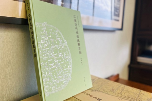
Filling the gap in the publication of specialized literature on Jiangnan maps, a collection of 228 modern maps of 63 central towns in Jiangnan has been released
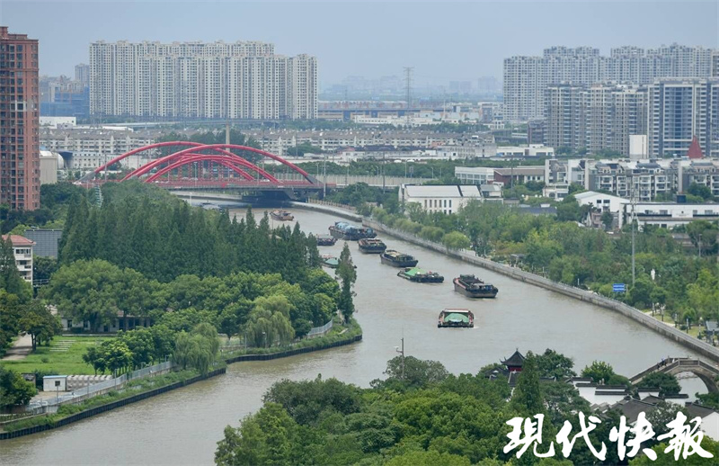
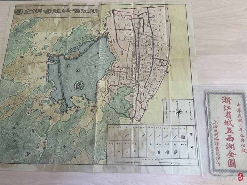
The historical map of Jiangnan towns is an important document carrier for recording the material civilization and cultural development of cities in the Jiangnan region of China. The rich graphic and textual information, exquisite surveying and printing, are like magnificent historical scrolls, intuitively reflecting the natural, cultural, and historical development and changes of Jiangnan water towns. In each historical map, from the macro layout of towns to the subtle details of streets and alleys, from important buildings such as city walls, government offices, schools, hospitals, temples, to transportation facilities such as water networks, roads, bridges, railways, as well as commercial centers, residential areas, and cultural elites, all are presented truthfully and objectively in front of readers.

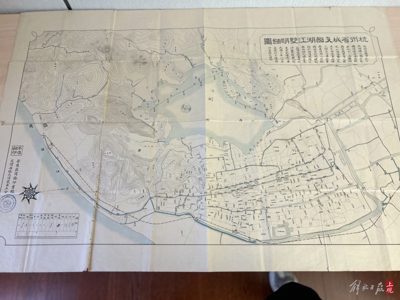
Provided by the publisher of "Compilation of Modern Town Maps in Jiangnan"
Provided by the publisher of "Compilation of Modern Town Maps in Jiangnan"
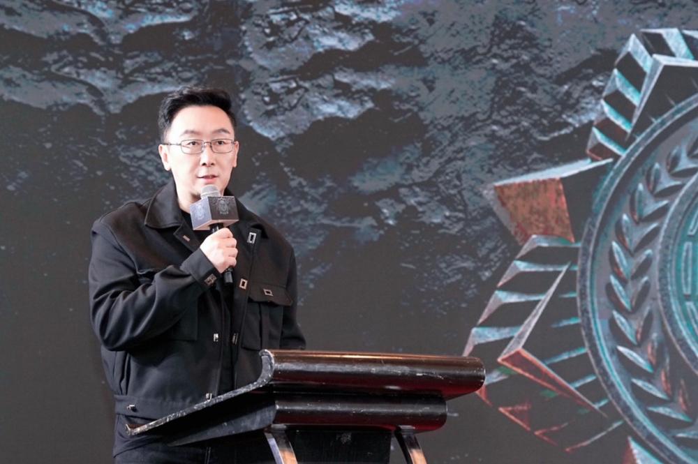
Zhong Chong, the director of the Institute of Ancient Books Compilation and Research at Shanghai Normal University, spent more than ten years collecting, organizing, and researching. He systematically sorted and selected the maps of Jiangnan towns that had declined since modern times, and compiled the "Compilation of Jiangnan Modern Town Maps" which was published by Shanghai Bookstore Publishing House. On September 16th, the symposium on the launch and publication of the new book was held at the Guangqi Academic Lecture Hall of Shanghai Normal University.
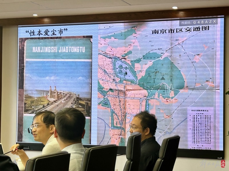
"This is the earliest map I collected when I was a child." At the beginning of the symposium, Zhong Chong presented a 1976 publication of "Nanjing City Traffic Map". At the time of publication, he was not yet 7 years old and his love for maps had already planted seeds. After starting his academic career, historical cartography has been a field that Zhong Chong has been cultivating for a long time, especially in the compilation and publication of large-scale historical map literature, which has achieved remarkable results. He has led the compilation of atlases such as "Shanghai Urban Map Integration", "Wenzhou Ancient and Old Atlas", and "Old City Scenic Spots: Japanese Modern Chinese Urban Bird's-eye View Map", which have innovative paradigms in the compilation methods and styles of historical atlases.

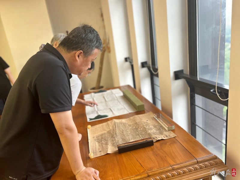
Photo taken by Shi Chenlu at the Publishing Symposium

The "Compilation of Modern Town Maps in Jiangnan" published this time is a selection of ancient maps of traditional water towns in the Jiangnan region of China and modern town maps before 1949. It includes 228 modern maps of 63 central towns in Jiangnan. The "Jiangnan" set in the book refers to the scope of eight prefectures and one prefecture, Suzhou, Songjiang, Changzhou, Hangzhou, Jiaxing, Huzhou, Ningbo, Shaoxing, and Taicang Prefecture, since modern times. As the first systematic compilation, organization, and publication of urban map literature in Jiangnan in recent years, this book fills the publishing gap of thematic literature on Jiangnan maps. The selected maps in the book are mostly those that were not included in the previous catalog books, especially the large-scale measured maps of many modern towns in Jiangnan. They are rarely collected by public and private collectors at home and abroad, and some of them are isolated maps that have been passed down. They are the first public publication in China and have both literary and cultural value.

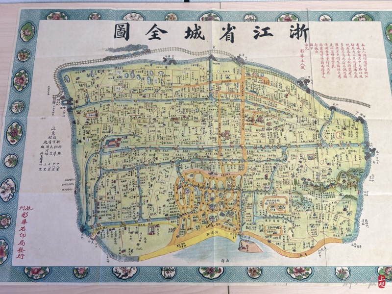
Provided by the publisher of the Catalogue of Modern Town Maps in Jiangnan

Provided by the publisher of the Catalogue of Modern Town Maps in Jiangnan
Zhong Chong introduced that in the process of selecting maps, two principles were followed. Firstly, two detailed maps, the new and the old, were selected from different stages before and after modern times. From the perspective of urban history and geography research, for the same town, detailed maps were selected from different stages before and after modern times as much as possible. This is an ideal path for conducting comparative research on the historical form of Jiangnan towns during the modern transformation period. It not only comprehensively reflects the urban system of various prefectures, counties, and prefectures in the core area of Jiangnan, but also clearly reflects the dynamic process of Jiangnan towns transitioning from prosperous ancient towns to modern towns through the comparison of the new and old maps; The second is to select the map with the highest research value in the history of modern Jiangnan urban mapping. The drawing of modern maps is closely related to the advancement of modern surveying and mapping technology. The surveying and mapping of urban areas in Jiangnan has gone through a process from traditional landscape drawing to the use of new surveying tools, and ultimately developed into triangulation and aerial surveying. These surveying and mapping forms are reflected in the Jiangnan urban maps included in the book. The emergence of modern maps also had its unique creative environment and distinct era personality in drawing and printing. In places such as Shanghai and Suzhou in Jiangnan, there have even been unique scenes of various printing methods coexisting, such as hand drawing, woodcarving, copperplate, stone printing, offset printing, etc. Among them, picture books and colorful stone printing maps are the most distinctive of the times, and these highly skilled urban maps are also important targets for inclusion.
Provided by publishers of urban maps of Changshu in different periods of modern times
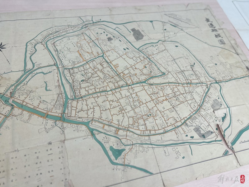
Provided by publishers of urban maps of Changshu in different periods of modern times
Provided by publishers of urban maps of Changshu in different periods of modern times
"Opening the map reveals the development of urban areas in Jiangnan, vividly and intuitively presented." Professor Zhou Zhenhe from the Institute of Historical Geography at Fudan University believes that the "Compilation of Modern Urban Maps in Jiangnan" basically covers the most important and representative urban maps in the Jiangnan region since modern times, providing rare historical materials and important clues for academic research on related topics.
The ancient map displayed at the symposium was taken by Shi Chenlu
The ancient map displayed at the symposium was taken by Shi Chenlu
The ancient map displayed at the symposium was taken by Shi Chenlu
The ancient map displayed at the symposium was taken by Shi Chenlu
All maps in the book retain their original appearance and are designed by professional technicians for color matching and layout, with high-definition graphics. The textual introduction is detailed and appropriate, providing rigorous and accurate analysis and interpretation of basic information, historical background, and value characteristics related to maps. Huang Jingbin, Deputy Director of the Department of History at Fudan University, believes that professional compilation and publication make this local atlas easier for the academic community to utilize.
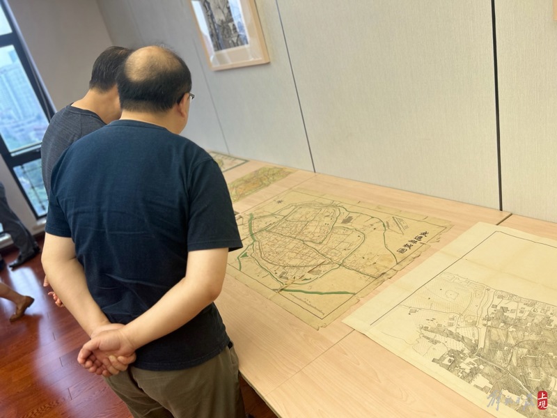
Experts and scholars visited the site of the symposium and displayed ancient maps taken by Shi Chenlu
Experts and scholars visited the site of the symposium and displayed ancient maps taken by Shi Chenlu
Presenting the historical and geographical changes of Jiangnan towns since modern times through a atlas also has contemporary value for the protection and restoration of the cultural and historical landscape of Jiangnan water towns. Zhong Chong said that how to creatively continue, upgrade, and reshape the Jiangnan towns with balanced regional economy and superior living environment in history, or the unique old urban areas embedded in big cities, while retaining elegant historical landscapes and profound cultural heritage, has become an important issue faced by planners, builders, and local residents. Explore the image historical materials of traditional towns in China and apply them to the construction of urban historical landscapes and ecological civilization, hoping to further promote the planning and design of high-level redevelopment of historical landscapes in water towns in Jiangnan, and deepen research on the protection of traditional culture in water towns.
"Understanding the origin and development of towns in Jiangnan is crucial for determining the direction of future development," said Su Zhiliang, director of the Urban Culture Center at Shanghai Normal University. This is precisely the practical significance of the "Compilation of Modern Town Maps in Jiangnan".