Then... move into the East China Sea tomorrow, and the direction will become more apparent! Typhoon "Kanu" continues to maintain its super typhoon level, waking up in China | Weather | East China Sea
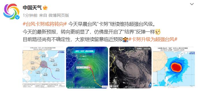
Upon waking up, Typhoon Kanu's turn became more apparent!
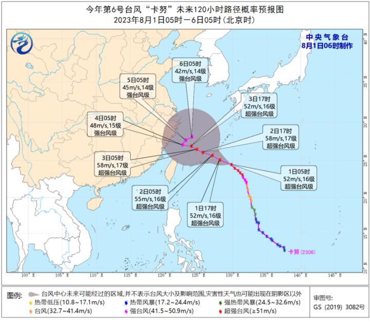
This morning, Typhoon "Kanu" continued to maintain its super typhoon level. According to @ China Weather, today's latest forecast has become more pronounced, as if it has opened a "boundary" rebound. At present, there is still uncertainty in the path, so please continue to pay attention to the approaching forecast.
According to the Central Weather Bureau's continued typhoon forecast at 06:00 on August 1st:
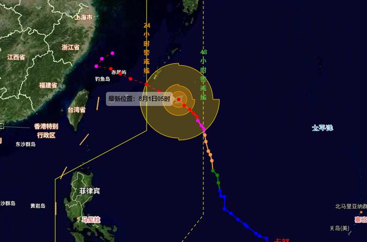
The center of Typhoon Kanu, the 6th typhoon of this year, was located at 5 o'clock this morning on the northwest Pacific Ocean, approximately 285 kilometers southeast of Naha, Okinawa. It is 24.5 degrees north latitude and 129.8 degrees east longitude. The maximum wind force near the center is 16 degrees, and the minimum pressure at the center is 935 hPa. The semi diameter of the Category 7 wind circle is 300-360 kilometers, the radius of the Category 10 wind circle is 120-140 kilometers, and the radius of the Category 12 wind circle is 70 kilometers.
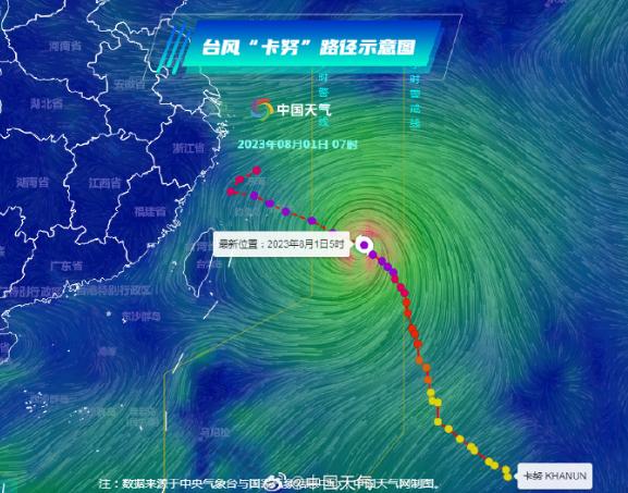
It is expected that "Kanu" will move towards the northwest at a speed of about 20 kilometers per hour, with increased intensity and approaching the southern waters of the Ryukyu Islands. It will move into the East China Sea on the morning of August 2 and gradually approach the coastal areas of central Zhejiang to northern Fujian.
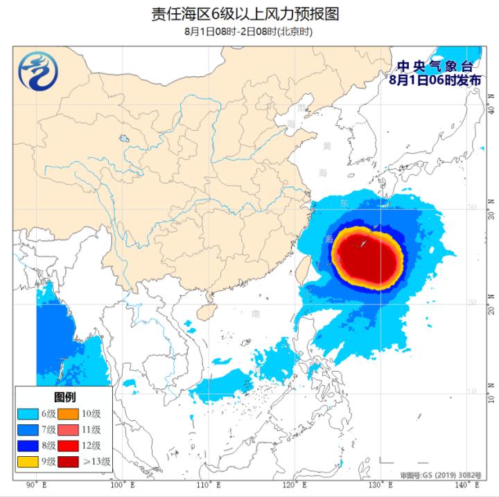
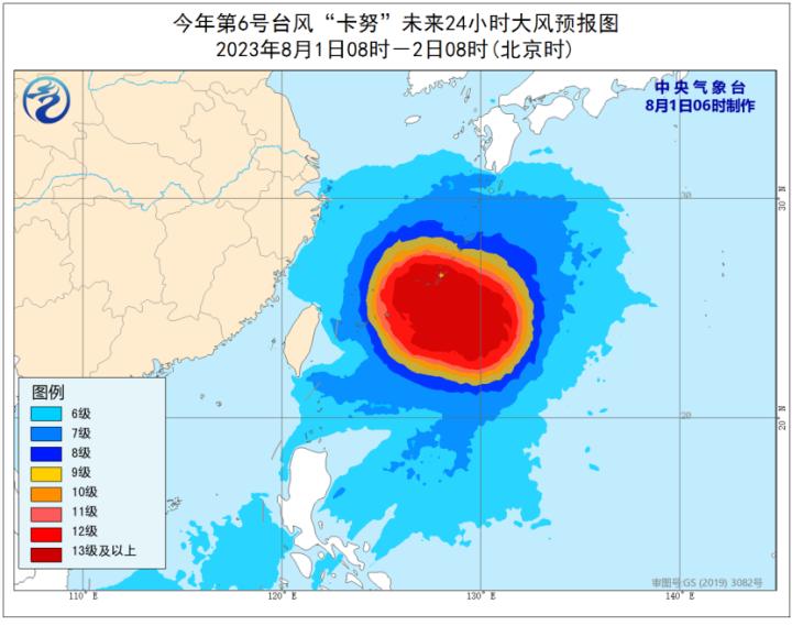
Gale forecast: From 08:00 on August 1st to 08:00 on August 2nd, there will be strong winds of force 6-8 and gusts of force 9-10 in most of the East China Sea and the waters near the Diaoyu Islands, the eastern waters of Taiwan, the Bashi Strait, and the eastern coast of Zhejiang and the northern coast of Taiwan Island. The wind in the southeastern part of the East China Sea can reach force 9-12 and gusts of force 11-14, while the wind in the waters near the "Kanu" center can reach force 13-16 and gusts of force 17 or above.
The eastern waters of China will be affected by Typhoon Kanu
1、 Weather conditions in the nearshore waters
From 14:00 on July 31 to 02:00 on August 1, northeast winds or easterly winds of magnitude 5-7 and gusts of magnitude 8 appeared in most of the East China Sea, while southwest winds of magnitude 5-7 and gusts of magnitude 8 appeared in the southwestern South China Sea.
2、 Key Weather Forecasts for Offshore Areas
1, China's eastern waters will be affected by typhoon "Kanu"
From the day of August 1 to the night of August 3, there will be strong winds of magnitude 6-8 and gusts of magnitude 9-10 in most of the East China Sea, Bashi Strait, Taiwan Strait, east of Taiwan, and most of the South China Sea. Among them, there will be strong winds of magnitude 9-12 and gusts of magnitude 13-14 in some parts of the sea area east of the East China Sea and Taiwan, the wind force in the sea area near the center of typhoon "Kanu" can reach 13~16, gust 17 and above. To this end, the Central Meteorological Station continued to issue the "Gale Yellow Warning" at 06: 00 on August 1.