China Pakistan Earth Resources Satellite Assists Amazon Rainforest Conservation Cooperation | Rainforest | Amazon
Rio de Janeiro, August 15 (Xinhua) - The Brazilian government announced in early August that the disappearance area of the Amazon rainforest in Brazil in July this year was 500 square kilometers, a year-on-year decrease of 66%. This data comes from the monitoring system of the Brazilian National Space Research Institute, and the Earth Resources Satellite, which China collaborates with Brazil, is an important source of data for this monitoring system.
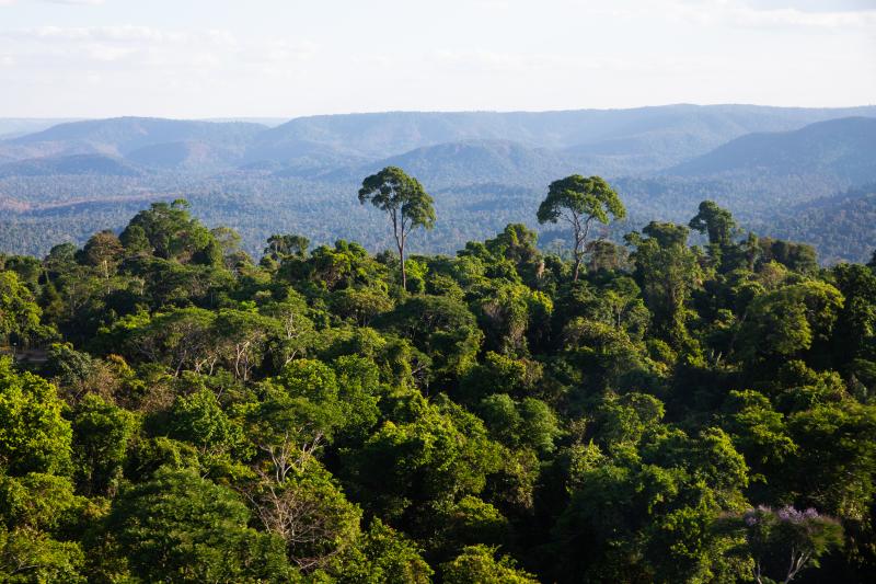
This is a protected Amazon tropical rainforest captured on August 3, 2023 at the Carajas Mining Complex in the state of Para, Brazil. Photo by Xinhua News Agency reporter Wang Tiancong
China and Brazil signed the Protocol between the Government of the People's Republic of China and the Federal Government of Brazil approving the development of Earth resource satellites in 1988. Both sides have jointly developed six China Pakistan Earth Resources series satellites: 01, 02, 02B, 03, 04, and 04A. Currently, 04 and 04A satellites are still in orbit, and both countries are developing 06 satellites to discuss plans for 05 satellites.
Antonio Carlos Pereira, head of the Earth Resources Satellite Program at the Brazilian National Space Research Institute, stated that the images provided by the Brazil China Earth Resources Satellite Program are widely used by Brazilian government agencies, research institutions, and private companies, especially in multiple projects aimed at monitoring and protecting the Amazon rainforest.
Pereira gave an example that a project called PRODES can provide annual deforestation data in the Brazilian Amazon region based on satellite images, while another project called DETER uses Earth Resources satellite images to monitor deforestation in real time and issue warnings.
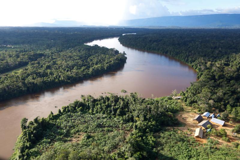
This is a village of the Amazon rainforest indigenous people in the state of Roraima, Brazil, captured on June 30, 2020. Shen Jizhong
During her visit to China in April this year, Brazilian Minister of Science and Technology Luciana Santos signed an agreement with China on behalf of the Brazilian government to accelerate the development of the Earth resource satellite 06 between the two countries. Santos stated in an interview with Xinhua News Agency that the 06 satellite will improve the monitoring of Brazilian biological communities, especially in the Amazon region, based on the already operational Bazhong Earth Resources Satellites 04 and 04A. "The Bazhong Earth Resources Satellite Project is crucial for curbing deforestation in the Amazon," Santos said.
Pereira has been involved in the China Brazil Earth Resources Satellite project since 1992 and became the head of the Earth Resources Satellite project at the Brazilian National Space Research Institute since 2013. He introduced that the 06 satellite is an upgraded version of the previous version of the satellite. "The previous satellite was an optical satellite, or rather an optical camera; and the 06 satellite will use synthetic aperture radar technology, which has the advantage of being able to monitor any region under different climate conditions, even if the region is experiencing clouds, rain, or wind and snow.".
In early August, member countries of the Amazon Cooperation Treaty Organization gathered in Beren, the capital of the Brazilian state of Para, located in the Amazon rainforest region, to discuss sustainable development of the Amazon rainforest and international cooperation on climate change. During the meeting, Brazilian Governor of Para state, Elder Barbaro, talked to Xinhua News Agency about the Brazil China Earth Resources Satellite Cooperation Project. He stated that technology plays a "decisive role" in monitoring the Amazon region and plays a role in identifying, containing, and preventing issues such as deforestation and forest fires.


