Bridge Island Tunnel Underwater Interchange Integrated! Looking at the "Chinese Plan" Behind the Construction of the "Underwater Great Wall" → Passage | World | Underwater
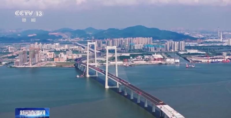
At 8 o'clock this morning, the final joint of the world's longest and widest steel shell concrete immersed tube tunnel, the Shenzhong Channel Submarine Tunnel, was successfully launched, accurately docked with the E24 pipe joint on the east side, and the "Underwater Great Wall" was officially closed. Shenzhen and Zhongshan officially held hands on the Lingdingyang seabed.
The 24 km Shenzhen China Channel is located in the core area of the Guangdong Hong Kong Macao Greater Bay Area, across the east and west sides of the the Pearl River Estuary, and connects Shenzhen, Guangzhou, and Zhongshan. It is a cross sea cluster project that integrates "bridges, islands, tunnels, and underwater connectivity" and is currently the most difficult to build in the world. Why adopt this cluster form? What are the difficulties of the project? Let's learn together.
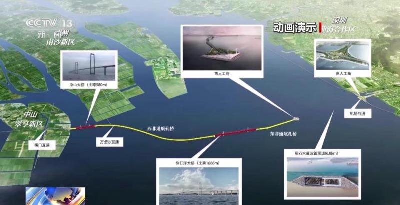
Within less than 2 minutes of driving from Hengmen Interchange, the car drove onto the Zhongshan Bridge of the Shenzhen Zhongshan Expressway. Traveling eastward from Zhongshan Bridge for about 2 kilometers, the Wanqingsha Interchange was specially designed on the non navigable span bridge, making it the world's first sea hub interchange. Vehicles can achieve convenient communication between Zhongshan, Guangzhou, and Shenzhen here.
The 24 kilometer long deep middle channel spans 22.4 kilometers across the sea, spanning three main waterways in Lingdingyang, and adopts the scheme of West Bridge and East Tunnel. The 17129 meter long bridge is divided into Zhongshan Bridge, West Africa Navigation Bridge, Lingdingyang Bridge, and East Africa Navigation Bridge from west to east.
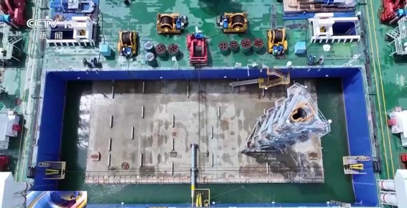
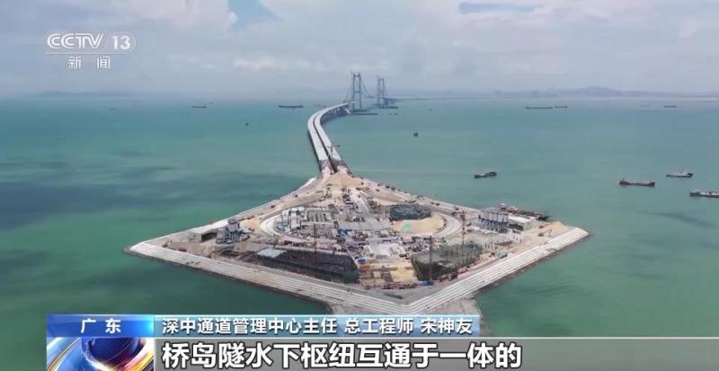
The immersed section of the 6845 meter long deep middle channel underwater tunnel is 5035 meters long, consisting of 32 pipe joints and 1 final joint. It is the world's longest and widest steel shell concrete immersed tunnel. Crossing the tunnel in about 6 minutes will lead to Dongren Island.
Song Shenyou, Director and Chief Engineer of Shenzhen China Channel Management Center: In the future, people on the west bank of the the Pearl River will realize rapid transit conversion with Shenzhen Airport and Qianhai by setting up a highway underwater hub interchange on the east bank, so this project will ultimately adopt the cross sea cluster project integrating bridge island tunnel underwater hub interchange.
The Shenzhong Passage project is located in the super typhoon area of the Lingdingyang Sea, crossing 11 fault structural zones. The West Artificial Island pilot project started in December 2016, and the entire line is a two-way eight lane highway with technical standards, a design speed of 100 kilometers per hour, and a design service life of 100 years.
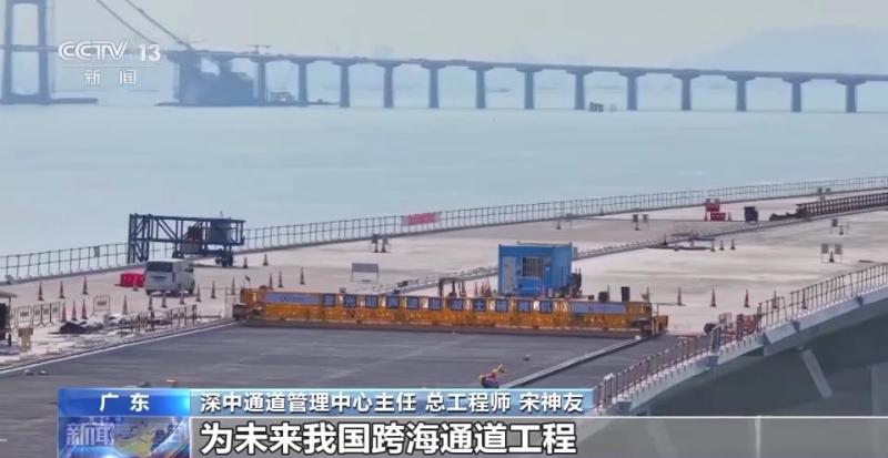
Song Shenyou, Director and Chief Engineer of the Shenzhong Channel Management Center: The Shenzhong Channel project has a large scale, high technical difficulty, and particularly complex construction conditions. After six years of overcoming difficulties, we have developed 10 of the world's top 10 integrated equipment, including intelligent pouring equipment and systems for steel shell concrete immersed tube tunnels. We have also developed 10 world leading technologies such as typhoon prone areas and wind and disaster resistance technology for ultra long span suspension bridges. Ultimately, we will form a complete set of technical standards and Chinese solutions for cross sea cluster projects, which will reserve technical and management experience for future cross sea channel projects in China.
At present, all the bridge projects of the Shenzhen Zhongshan Channel have been completed. With the completion of the underwater immersed tube tunnel, the "bridge, island, tunnel, and underwater interchange" project will be fully completed by the end of this year, and it is expected to be completed and opened to traffic next year.
After opening to traffic, the time from Shenzhen to Zhongshan will be shortened from the current one and a half hours to about half an hour, which is of great significance to the construction and improvement of the comprehensive three-dimensional transportation network of the Guangdong Hong Kong Macao Greater Bay Area. It will further shorten the space and time distance between the east and west sides of the Pearl River Estuary, and improve the level of "hard connectivity" and "soft connectivity" in the Greater Bay Area.