How will the wind and rain be in Shanghai tomorrow? When "Dussuri" makes landfall, it may be a super typhoon level. Typhoon level 1 will respond and activate Typhoon | Dussuri | Activate
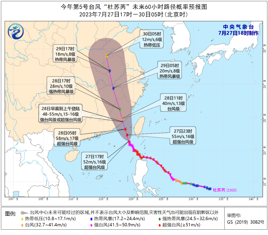
According to monitoring information from the Central Meteorological Observatory, Typhoon "Dussuri" once again strengthened to a super typhoon level at 17:00 today, with a maximum wind force of 16 levels near the center. Although it is not as strong as the 17 levels of the previous two days, its power cannot be underestimated. This afternoon, the China Meteorological Administration has initiated a Category 1 typhoon response.
The landing forecast for Du Suri has also been adjusted. Previous forecasts showed that "Dussuri" made landfall at typhoon or strong typhoon level, with the landing location from Jinjiang, Fujian to the border of Fujian and Guangdong; According to the latest forecast, the intensity of Typhoon Du Suri's landfall is expected to increase, with a strong typhoon or super typhoon level, and the landing location will change to the coastal area from Dongshan in Fujian to Putian.
As of 17:00 today, the center of Typhoon Du Suri is only 360 kilometers southeast of Xiamen City, Fujian Province. Has the impact of wind and rain on Shanghai changed after the adjustment of "Du Suri"?
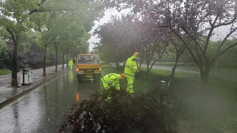
According to the latest forecast results of Shanghai center Meteorological Observatory, the impact of wind and rain has not changed much. It is expected that there will be occasional showers or thunderstorms in Shanghai from tonight to Saturday, with obvious characteristics of intermittent precipitation. Local areas will have rainfall of 30 to 50 millimeters, and the maximum hourly rainfall intensity will be 20 to 40 millimeters.
In terms of strong winds, tomorrow the wind will gradually increase to level 5 with gusts of 6 to 7. The gusts in coastal areas along the Yangtze River will be level 8, and the sea surface winds in Yangshan Port and Shanghai will be level 8 to 9. The wind will gradually weaken on Saturday night.
Tomorrow's storm in Shanghai is similar to today's, so citizens don't have to be too nervous. This time, Shencheng is affected by the periphery of the typhoon, with wind and rain, but it will not continue to be stormy. Its impact on the safety of local flights and train operations in Shanghai is relatively small, but "Du Suri" has a greater impact on the Fujian Guangdong region and transportation. Citizens who plan to travel to these areas need to pay more attention to traffic information.
The forecast shows that Typhoon "Dussuri" weakened northward after landfall, and with the westward extension and strengthening of the subtropical high pressure, Shanghai will be on the edge of the subtropical high pressure, returning to the "cloudy+afternoon thunderstorm" mode, with temperatures rising slightly. It is expected that the highest temperature at the end of the month will be around 33 ℃. But the forecast is still changing, and the tropical system over the sea is active in early August. Tropical cloud clusters have developed and formed a tropical depression on the east side of "Du Su Rui", which will bring variables to the future weather in East China.